
| Home | About Project: South Ridge | Project: South Ridge Downloads | Project: South Ridge Games | Project: South Ridge Wiki |
|---|

Northern Terminus: Fox, OK
Southern Terminus: Barrier Point, SR
National Highway 5 was constructed in 1926, originally known as the "Bayshore Highway." It starts at an intersection with National Highway 21 in Barrier Point, South Rige and goes north to an intersection with National Highway 2 in Rural Fox Township, Oakland. This highway was one of the first built and served as a primary access route for people from the south to easily reach the Capital District.
Major Cities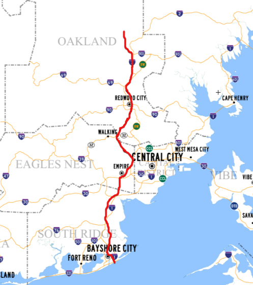

A  project. Website design, maps, other images ©2020-2021 Cube Studios. Twitter, Discord, Roblox, Twitch, YouTube, and Instagram logos are all properties of their respective owners.